1
/
of
1
Lighthouse MAD Lab
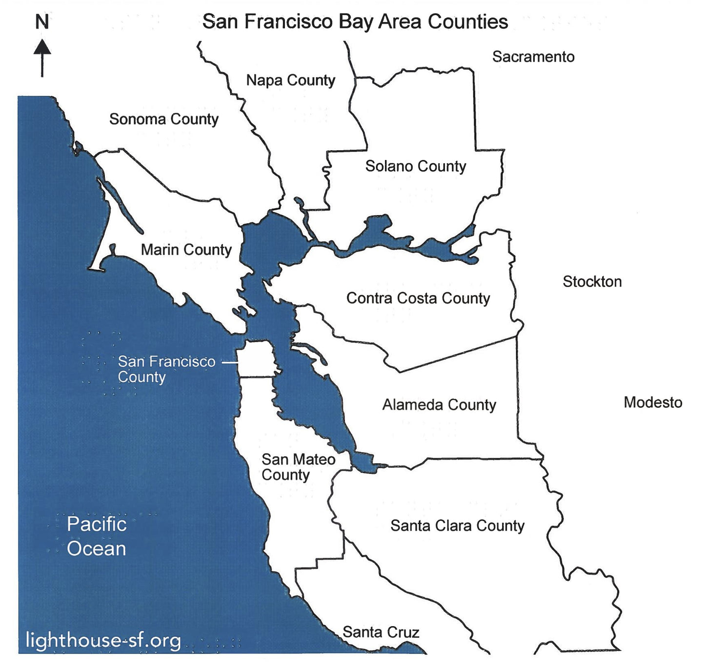
Braille Maps- SF Bay Area Counties + key
Braille Maps- SF Bay Area Counties + key
⚠️ Important Notice for MAD Lab Products ⚠️
Please note: MAD Lab items are custom-made and require a minimum 2-week turnaround time. Production begins after your order is placed. Thank you for your patience and understanding!
Regular price
$20.00 USD
Regular price
Sale price
$20.00 USD
Unit price
/
per
Shipping calculated at checkout.
Couldn't load pickup availability
A MAD Lab exclusive! Printed here at the LightHouse, this map displays all of the counties in the San Francisco Bay Area, in large print, Braille, with tactile markers delineating their boundaries.
*A single map is included, along with a key that displays the abbreviations in Braille for the counties alongside their full names.
Share


